7 Breathtaking Hidden Trails You Need to Hike This Summer

The Crystal Lake Alpine Trail
Mossy Glen Forest Path
Eagle Peak Summit Route
Sunset Ridge Loop
Hidden Falls Canyon Trail
Summer's here. The well-known trails are packed with crowds, parking headaches, and that guy blasting music from a portable speaker. This guide covers seven lesser-known hiking trails that deliver stunning views, solitude, and the kind of wilderness experience that makes the effort worthwhile. Each trail on this list stays off the mainstream radar while offering scenery that rivals—or beats—the popular alternatives.
What Makes a Trail "Hidden"?
A hidden trail isn't just remote. It's overlooked, unmarked on the average tourist map, or overshadowed by a famous neighbor. These routes don't show up in every guidebook. Parking lots hold ten cars, not a hundred. The payoff? Wildlife encounters are more likely. Photo ops don't require waiting in line. And the silence—actual silence—is worth the extra research it takes to find them.
That said, "hidden" doesn't mean "secret." These trails are public, legal, and maintained. They simply require more effort to locate and reach than the average weekend hiker is willing to invest.
How Do You Find Hidden Hiking Trails Near You?
Start with AllTrails filters—sort by "least traveled" and check reviews from the past year. Local Facebook groups and Reddit communities (r/hiking, r/CampingandHiking) often share beta that never hits mainstream apps. State park websites list trails that don't rank in Google results. And don't underestimate the value of a good old-fashioned conversation with a ranger at the visitor center.
1. The Terraced Lakes Trail, Uinta Mountains, Utah
Everyone flocks to Zion and Arches. The Uintas—Utah's only major east-west mountain range—remain strangely quiet. The Terraced Lakes Trail winds past five alpine lakes in under six miles, each one sitting in a glacial basin like a step on a staircase.
The trailhead starts at Mirror Lake Highway, but most drivers pass right by. You'll climb through spruce-fir forest, break into meadows thick with wildflowers in July, and reach the upper lakes where Brooks Cascadia 16 trail runners grip the granite slabs better than standard hiking boots. Bring a fly rod—Brook trout cruise these shallows, and catch-and-release keeps the fishery healthy.
Camping is restricted around the lower lakes (too many people used to trash them), but the upper basins allow dispersed camping if you follow Leave No Trace principles. Water filtration is mandatory. Giardia doesn't care how pristine the water looks.
2. The Devil's Path Traverse, Catskills, New York
Just two hours from Manhattan sits one of the hardest day hikes in the Northeast. The Devil's Path earns its name with seven major peaks, 4,000 feet of elevation gain, and sections where you're using hands more than feet. Most hikers cherry-pick a section. Doing the full traverse in a day? That's for the committed—or the slightly unhinged.
The trail crosses Indian Head, Twin, Sugarloaf, Plateau, West Kill, Hunter, and Southwest Hunter mountains. Each summit delivers views across the Hudson Valley that rival the Adirondacks' High Peaks, minus the crowds. The rock scrambles on Indian Head and Twin force you to slow down and think—rushing here ends in a rescue.
Here's the thing: this trail isn't for beginners. The Escarpment Trail gets all the Instagram love, so Devil's Path stays under the radar. Pack more water than you think you need. The ridges are exposed, and summer humidity in the Catskills will dehydrate you faster than desert air.
3. The Enchantment Lakes Approach via Stuart Lake, Washington
The Enchantments are famous. The lottery system for overnight permits fills within hours. But there's a loophole—day hikers can access the lower enchantment basin via Stuart Lake trail without a permit, and the scenery is 90% as spectacular for 50% of the effort.
Stuart Lake itself sits at 4,600 feet, framed by the sheer granite walls of Mount Stuart—the largest single rock face in the Cascades. Continue past the lake on bootpaths to Colchuck Lake's northern shore, and you're standing where most permit-holders camp, without the lottery stress.
The catch? It's still 10 miles and 3,000 feet of gain. The trail starts in pine forest near Leavenworth, switchbacks through beargrass meadows (blooming spectacularly in late July), and hits snow patches that linger into August. REI's Co-op Trailbreak Trekking Poles earn their weight on the descent—knees take a beating on the relentless downhill.
4. The Lost Coast Trail, Sinkyone Wilderness, California
Everyone knows the northern Lost Coast Trail in Kings Range. The southern section in Sinkyone Wilderness State Park? Almost empty. The reasons are practical: no shuttles, harder access, and a trail that disappears into beach sand for miles at a time.
That's exactly why it's worth doing.
The trail runs 16 miles from Usal Beach to Bear Harbor, threading through old-growth redwoods that were never logged, past Roosevelt elk herds that act like you don't exist, and along cliffs where waves explode 100 feet below. Tides dictate your schedule—plan using NOAA tide charts, or you'll be waiting on beaches for hours.
Water sources are unreliable in late summer. The Usal Creek crossing can be waist-deep after rain. And the "trail" often means following stakes through head-high fennel and poison oak. Worth noting: this is where Patagonia's Granite Crest Rain Jacket proves its value—fog rolls in without warning, and that marine layer doesn't burn off until noon.
Which Hidden Trails Are Best for Beginners?
Not every hidden trail demands technical skills. The next three options offer solitude without the risk factor—perfect for building confidence, testing gear, or introducing new hikers to the backcountry.
| Trail | Distance | Elevation | Difficulty | Best Feature |
|---|---|---|---|---|
| Terraced Lakes | 6 miles | 1,200 ft | Moderate | Alpine lake chain |
| South Manitou Island | Various | 500 ft | Easy-Moderate | Isolation, shipwrecks |
| Grayson Highlands | Up to 12 miles | 1,500 ft | Moderate | Wild ponies, balds |
5. South Manitou Island, Sleeping Bear Dunes, Michigan
The ferry from Leland drops you on an island with 15 miles of trails, zero cars, and a campground that rarely fills. Most visitors day-trip to the lighthouse and leave. Hikers who overnight get deserted beaches, old-growth cedars that predate European arrival, and the eerie remains of shipwrecks visible in the shallows.
The trail network loops through forest, past historic farms, and along bluffs 300 feet above Lake Michigan. The North Bar Lake trail leads to a pristine swimming beach where the water temperature hits 70°F by August—warm for the Great Lakes. You'll carry all water in or filter from the lake. The island has no services.
Permits are required but easy to get through the National Park Service. The ferry runs twice daily in summer. Miss the return boat and you're camping another night—plan accordingly.
6. Grayson Highlands State Park, Virginia
The Appalachian Trail passes through here, but most thru-hikers skip the side trails that lead to the park's best features. Wilburn Ridge and the Appalachian Trail itself offer crowds. The Pine Mountain Trail and Cabin Creek Trail deliver the same wild ponies, the same balds covered in blueberries, and fraction of the people.
The ponies are feral—descended from stock released during the Depression. They bite. They'll steal food from unattended packs. But watching a herd graze against a backdrop of 5,000-foot peaks at sunrise is worth the hassle.
September is prime time. The blueberries ripen, the ponies fatten up, and the summer humidity breaks. Campsites at Hickory Ridge require reservations, but the park's backcountry sites operate on a self-registration system that almost never fills.
7. The Citadel, Weminuche Wilderness, Colorado
Colorado's largest wilderness area hides in the southwestern corner of the state, hours from Denver's front range crowd. The Citadel is a 13,000-foot peak that's technically a walk-up, but the approach requires navigation skills, river crossings, and the willingness to carry gear for three days.
The payoff is a summit that sees maybe ten parties per year. From the top, you can trace the Continental Divide for fifty miles in either direction. The Chicago Basin—famous for its train access and fourteeners—sits visible but distant, packed with climbers while you stand alone.
Access starts at the Thirty Mile Campground on the Rio Grande. Follow the Weminuche Trail to the Devil's Creek cutoff, then bash upstream through willows until you hit treeline. There's no trail for the final two miles—just cairns, instinct, and the knowledge that getting lost here means a very long walk out.
The standard route up the east ridge requires no technical climbing, but exposure on the final 500 feet demands confidence on loose rock. Start early—afternoon thunderstorms build fast above treeline, and the Citadel offers zero shelter.
What Gear Do You Need for Hidden Trails?
The usual suspects—good boots, layered clothing, navigation tools—but with emphasis on self-sufficiency. Hidden trails don't have rescue infrastructure. Cell service is theoretical. Your gear needs to handle problems without external help.
Carry the CalTopo app with offline maps downloaded. Bring a physical compass and know how to use it. Pack a SOL Emergency Bivvy even on day hikes—hypothermia kills more hikers than bears, and summer storms can drop temperatures 40 degrees in an hour.
Water purification is non-negotiable. The Sawyer Squeeze filters fast, weighs nothing, and screws onto standard bottles. Backup water treatment tablets live in every first-aid kit—because filters freeze, clog, or get dropped in creeks.
That headlamp in your pack? Check the batteries. "Just going for a day hike" turns into an overnight when you miss a junction, twist an ankle, or realize the trail description was written by someone who jogged it in trail runners while you have a 40-pound pack.
Final Thoughts on Summer Hiking
The best trails aren't always the ones with parking lots and visitor centers. Sometimes they're the ones you find by studying topo maps at midnight, the ones where the trail register shows three names in the past month, the ones where you won't see another soul for twelve hours.
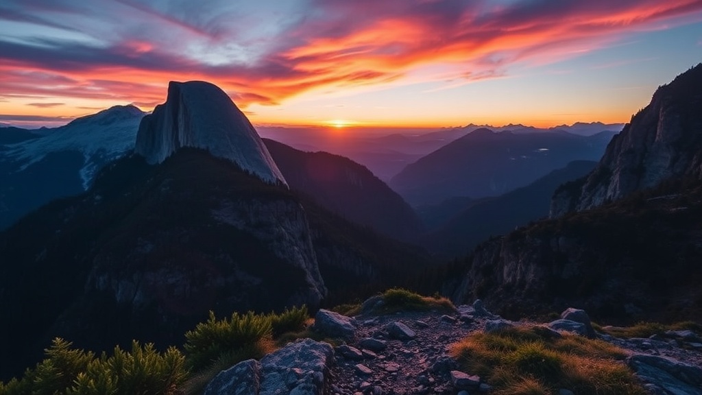
These seven trails offer that experience. They're harder to reach, harder to follow, and harder to forget. Start training now. Book the permits. And when August hits and your social media feed fills with photos from Angels Landing and Half Dome, you'll be somewhere better—somewhere the crowds haven't discovered yet.